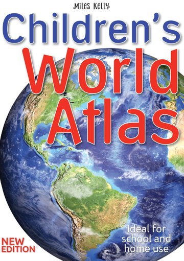
Children's World Atlas (Hardcover)
Children’s World Atlas is a comprehensive, detailed world atlas for kids, perfect for supporting classroom work and homework.
Older children will learn how to use an atlas and will gain an understanding of the world around them.
What are the key features of Children’s Atlas of the World?
- A political and physical world map for kids to investigate.
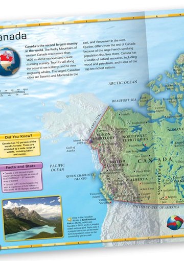
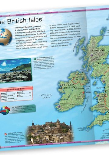
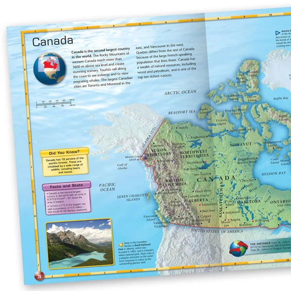
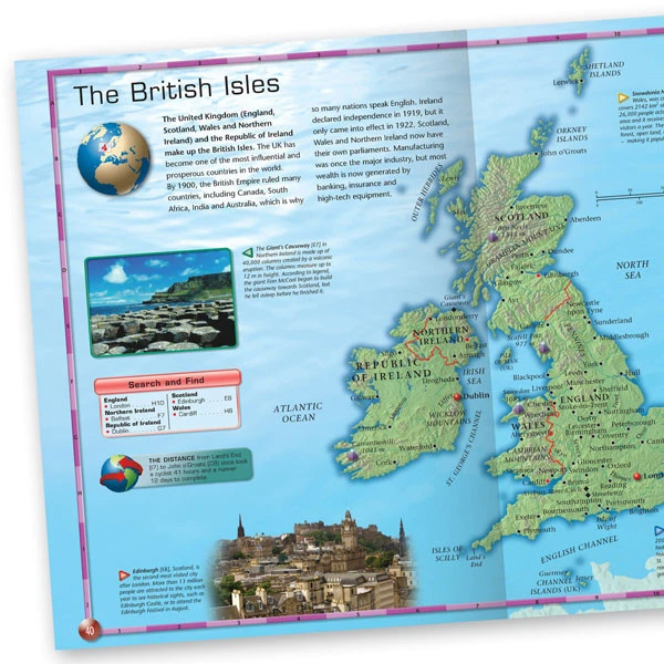
- Each continent and country is illustrated with a full-colour physical map, annotated with capitals, towns, oceans, rivers and mountains
- Amazing photographs of key landmarks and sights for each country group, giving your child a feel for different cultures and places
- Search and find panels list capital cities and their grid references, providing an interactive tool that will teach children how to locate features on a map using a graticule.
- Special features – Extreme Weather, World Record and In the next minute… – present the most extraordinary facts in context so children can understand the stats
Special features include:
- Extreme Weather:
- Hurricane Katrina, the largest hurricane ever recorded in the USA, caused 80 percent of New Orleans [H6] to flood.
- More than one million people were evacuated and 1833 died.
- In the next minute… at least five icebergs will fall into the oceans – enough fresh water to supply London for a day.
- Did You Know? Modern chewing gum is made from the same gum the Aztecs chewed, with added sweetener to make it more tasty.
- Facts and stats:
- Italy’s population of 60.3 million would fill 603 Olympic stadiums.
- Montenegro’s population of 620,000 would fill six stadiums.
- World Record:
- The Sahara sand sea in Algeria has the longest sand dunes in the world, with some more than 300 km.
- The distance from… Australia’s east coast to the west coast is 3000 km – the same as from London to Boston, USA
- Star fact: Mount Fuji [G9] is an active volcano, but last erupted in 1707. More than 200,000 people walk to its snow-capped summit each year.
Suitable for children 10 and above.
ISBN: 9781786170866
Dimensions (mm): 305 x 232 x 13
- Magazines subscriptions cannot be cancelled/ refunded / transferred.
- No exchanges nor refunds allowed on all other items
- Deliveries addresses within mainland Singapore only
Children’s World Atlas is a comprehensive, detailed world atlas for kids, perfect for supporting classroom work and homework.
Older children will learn how to use an atlas and will gain an understanding of the world around them.
What are the key features of Children’s Atlas of the World?
- A political and physical world map for kids to investigate.
- Each continent and country is illustrated with a full-colour physical map, annotated with capitals, towns, oceans, rivers and mountains
- Amazing photographs of key landmarks and sights for each country group, giving your child a feel for different cultures and places
- Search and find panels list capital cities and their grid references, providing an interactive tool that will teach children how to locate features on a map using a graticule.
- Special features – Extreme Weather, World Record and In the next minute… – present the most extraordinary facts in context so children can understand the stats
Special features include:
- Extreme Weather:
- Hurricane Katrina, the largest hurricane ever recorded in the USA, caused 80 percent of New Orleans [H6] to flood.
- More than one million people were evacuated and 1833 died.
- In the next minute… at least five icebergs will fall into the oceans – enough fresh water to supply London for a day.
- Did You Know? Modern chewing gum is made from the same gum the Aztecs chewed, with added sweetener to make it more tasty.
- Facts and stats:
- Italy’s population of 60.3 million would fill 603 Olympic stadiums.
- Montenegro’s population of 620,000 would fill six stadiums.
- World Record:
- The Sahara sand sea in Algeria has the longest sand dunes in the world, with some more than 300 km.
- The distance from… Australia’s east coast to the west coast is 3000 km – the same as from London to Boston, USA
- Star fact: Mount Fuji [G9] is an active volcano, but last erupted in 1707. More than 200,000 people walk to its snow-capped summit each year.
Suitable for children 10 and above.
ISBN: 9781786170866
Dimensions (mm): 305 x 232 x 13
- Magazines subscriptions cannot be cancelled/ refunded / transferred.
- No exchanges nor refunds allowed on all other items
- Deliveries addresses within mainland Singapore only
Can we recommend?
 PRIMARY 6 MASTERING ENGLISH - 2ND EDITION
PRIMARY 6 MASTERING ENGLISH - 2ND EDITION
S$18.50
PRIMARY 6 MASTERING ENGLISH - 2ND EDITION
PRIMARY 6 MASTERING ENGLISH - 2ND EDITION
PRIMARY 6 MASTERING ENGLISH - 2ND EDITION
S$18.50
") Key Guide O-Level English: Mastering Paraphrasing Skill...
Key Guide O-Level English: Mastering Paraphrasing Skill...
Key Guide O-Level English: Mastering Paraphrasing Skill...
S$16.24
Key Guide O-Level English: Mastering Paraphrasing Skill...
Key Guide O-Level English: Mastering Paraphrasing Skill...
Key Guide O-Level English: Mastering Paraphrasing Skill...
S$16.24
 Science Educational Toy For Kids Play N Learn Mini Pock...
Science Educational Toy For Kids Play N Learn Mini Pock...
S$8.90
Science Educational Toy For Kids Play N Learn Mini Pock...
Science Educational Toy For Kids Play N Learn Mini Pock...
Science Educational Toy For Kids Play N Learn Mini Pock...
S$8.90


